
Satellite images have captured the extent of the devastation caused by wildfires in Texas.
The unbridled Smokehouse Creek Fire, the largest of all the blazes, has been burning since Monday.
It has spread to the Oklahoma border after starting near towns northeast of Amarillo – and the weather forecast for the weekend threatens to fuel it further.
At least one person, an 83-year-old woman in Hutchinson County, was reported by local media to have died in the blaze.
Firefighters managed to carve containment lines around just 3% of the fire as of Wednesday night, officials said.
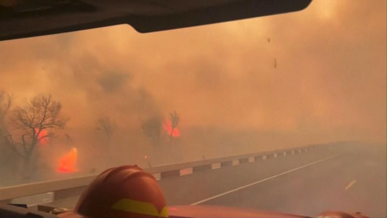
Fire truck drives through wall of flames
An area covering 1,300 square miles – equivalent to twice the size of London – has been burned so far, making the Smokehouse Fire the second largest in the state‘s history, only just smaller than 1,400 square miles burned in a 1996 blaze.
US space technology company Maxar Technologies has shared images of the wildfire from above, highlighting how widespread the fire – which is one of several burning in the state – has been.
Cooler temperatures are expected on Thursday with a chance of rain, which gives firefighters a chance to increase containment ahead of another increase in temperatures over the weekend.
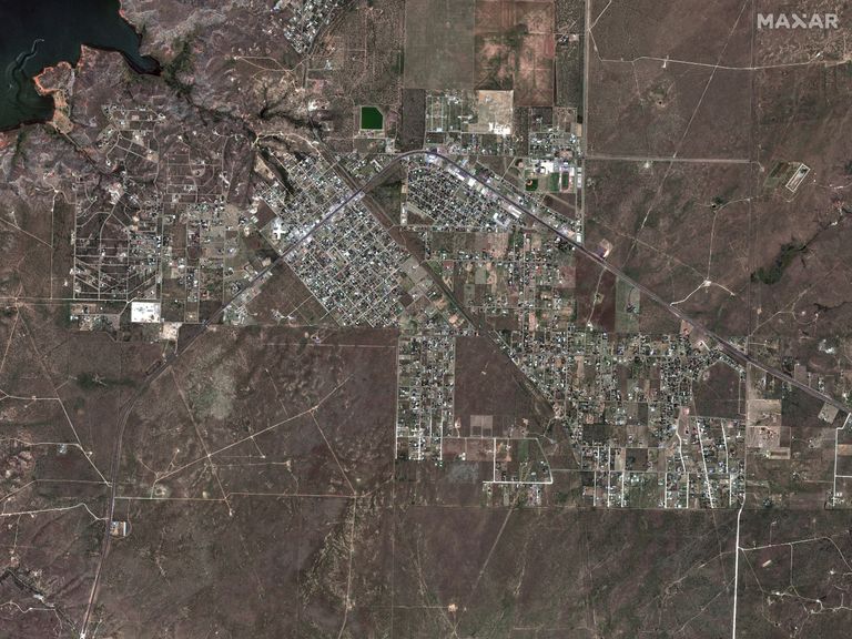
The city of Fritch before…
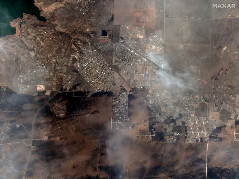
…and after. Pics: Maxar Technologies
Authorities have not said what ignited the fires, but strong winds, dry grass and unseasonably warm temperatures have fed the flames.
Nim Kidd, chief of the Texas Division of Emergency Management, said the weekend forecast and “sheer size and scope” of the blaze are the biggest challenges for firefighters.
“I don’t want the community there to feel a false sense of security that all these fires will not grow anymore,” he said. “This is still a very dynamic situation.”
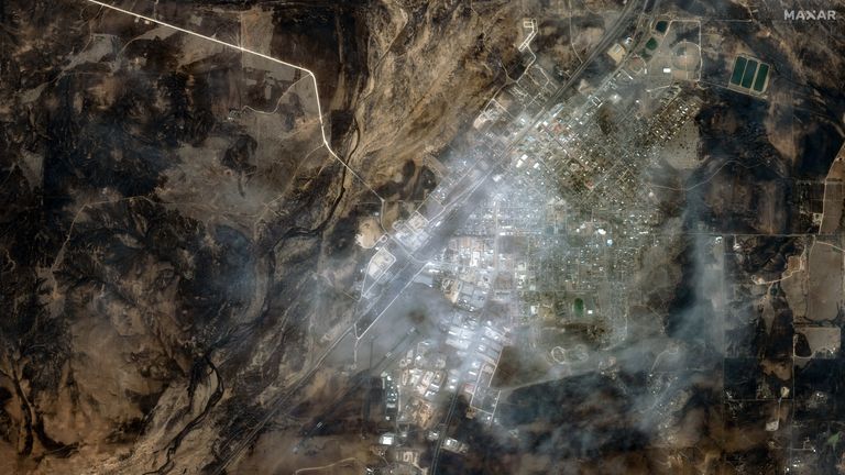
The city of Canadian in Texas. Pic: Maxar Technologies
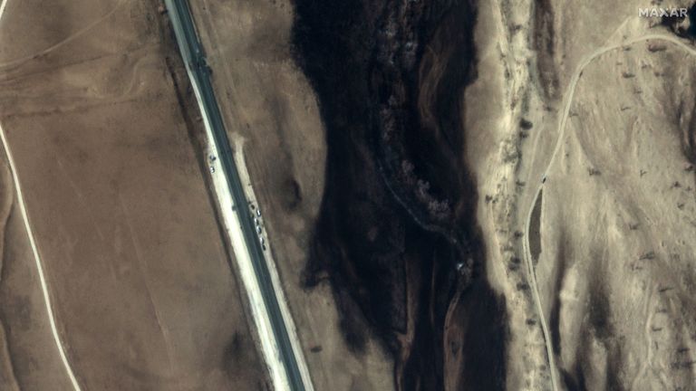
The charred landscape near Canadian. Pic: Maxar Technologies
Flames have been pushed by powerful winds across the sparsely populated region, with smoke delaying aerial surveillance of the damage in some areas.
“There was one point where we couldn’t see anything,” said Greg Downey, 57, describing his escape as the fire bore down on his neighbourhood.
“I didn’t think we’d get out of it.”
A nuclear weapon plant near was partly evacuated on Tuesday night and paused operations due to an out-of-control blaze approaching its Panhandle site near Amarillo.
Read more from Sky News:
Biden still ‘fit for duty’ at 81, doctor says
Court to decide if Trump can be prosecuted over Capitol riot
Rare plant’s intense stench attracts visitors in San Francisco
The woman who died was identified by family members as former substitute teacher Joyce Blankenship.
Her grandson, Lee Quesada, said officers told his uncle on Wednesday they had found her remains in her burned home.